
Research Profile
Research Experience
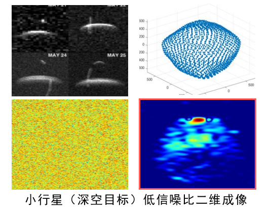
Remote Sensing Image Reconstruction under Challenging Observations
Research on remote sensing image reconstruction, enhancement, and spatial reconstruction from noisy and incomplete observations.
- Remote Sensing Reconstruction: Developed physics-aware and learning-based methods for remote sensing image reconstruction under low-SNR, sparse-sampling, and complex-motion conditions.
- Spatiotemporal Signal Modelling: Modelled non-stationary remote sensing observations and developed nonlinear parameter-estimation methods for long-duration and low-SNR data.
- Self-Supervised Enhancement: Developed self-supervised approaches for image enhancement and structure preservation.
- Multi-view Reconstruction: Investigated multi-view fusion and spatial reconstruction methods for recovering structural information from limited observations.
Time-Series Imputation and Long-Horizon Multimodal Learning
Research on time-series imputation and multimodal learning for incomplete and long-horizon observations.
- Time-Series Imputation: Developed self-supervised methods for reconstructing missing spatiotemporal observations.
- Sparse Imaging: Designed physics-aware methods for high-resolution imaging with up to an 80% missing observation rate.
- Multimodal Time-Series Learning: Investigated VLM-based modelling of long-horizon time series by retaining informative temporal segments and removing redundant observations.
- Efficient Representation: Explored attention-guided temporal token selection for efficient multimodal reasoning.
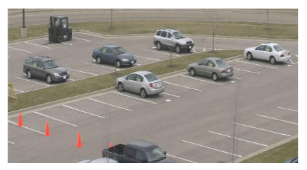
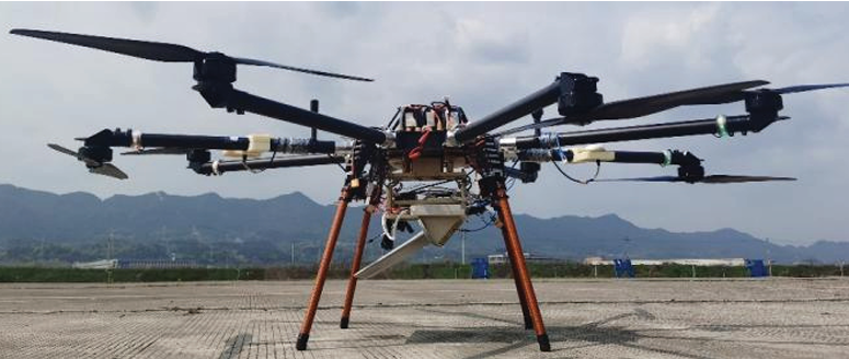
UAV-Based Urban Remote Sensing and Spatial Reconstruction
Developed UAV-based remote sensing and spatial reconstruction methods for complex urban environments.
- Urban Data Acquisition: Participated in 40+ UAV sorties at 170–260 m for urban sensing and multi-view data collection.
- Motion Estimation: Developed physics-based motion estimation methods for low-SNR and complex-motion observations.
- Remote Sensing Imaging: Applied physics-aware methods for high-resolution imaging under low-SNR conditions.
- Spatial Reconstruction: Developed multi-view 3D reconstruction methods, achieving sub-meter reconstruction accuracy on representative urban scenes.
Long-Horizon Radar Remote Sensing and 3D Reconstruction
Research on long-duration observations, image enhancement, and 3D reconstruction of non-cooperative targets.
- Long-Horizon Time-Series Analysis: Modelled long-duration observations by jointly considering target motion and scatterer distribution, enabling simultaneous estimation of motion parameters and 3D structure.
- Image Enhancement: Developed self-supervised enhancement methods, achieving 10–15 dB SNR improvement.
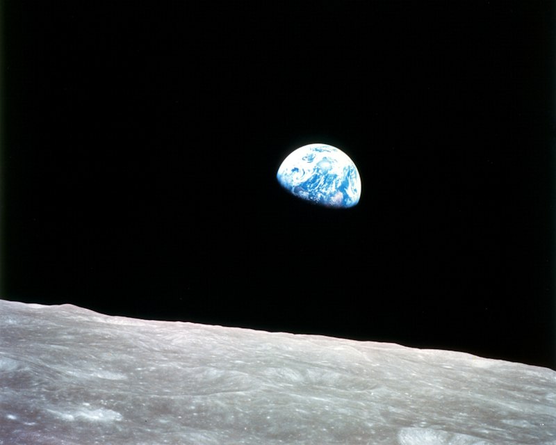
- Multi-view Sensing: Investigated sparse-view reconstruction methods for lunar-surface 3D reconstruction.
- Real-world Validation: Conducted 100+ experiments and processed TB-scale sensor data for algorithm validation.
Selected Publications & Patents

Multi-Dimensional Spread Target Detection with Across Range-Doppler Unit Phenomenon Based on Generalized Radon-Fourier Transform
Remote Sensing | First Author
Published
Scattering-Aware Multi-View Masked Networks for Self-Supervised Radar Denoising
IEEE Transactions on Geoscience and Remote Sensing | First Author
Under Review
A Self-supervised Radar Sparse Imaging Method via Physics-Aware Imputation Network
IEEE Transactions on Aerospace and Electronic Systems | First Author
Under Review
A Parametric 3-D ISAR Imaging Method of Celestial Target Under Low SNR
IEEE Transactions on Geoscience and Remote Sensing | Co-author
Published
An Adaptive 3-D Reconstruction Method for Targets Based on Multi-view Self-supervised Framework under Low SNR
IEEE Transactions on Aerospace and Electronic Systems | First Author
Under Review
Method for Multi-view 3D Sensing under Low SNR
Chinese Invention Patent | First Student Inventor
Granted
Sensor Denoising Method Based on Self-Supervised Learning
Chinese Invention Patent | First Student Inventor
Granted
Self-Supervised Image Denoising Method Based on an Adaptive Masking Strategy
Chinese Invention Patent | First Student Inventor
Patent Application
Image Reconstruction Method Based on a Self-Supervised Inpainting Network
Chinese Invention Patent | First Student Inventor
Patent ApplicationEducation
Relevant coursework: Signals and Systems, Digital Signal Processing, Communication Principles.
Technical Skills
-
Radar & Remote Sensing
- SAR / ISAR imaging
- Image reconstruction and enhancement
- Target detection and parameter estimation
- Signal processing
-
Temporal Modelling
- Missing-data imputation
- Long-horizon sequence modelling
- Temporal representation learning
- Attention-guided temporal selection
-
Learning Methods
- Self-supervised learning
- Transformer and multimodal learning
- Diffusion models
- Deep unfolding
-
Spatial Methods
- Multi-view reconstruction
- Sparse-view reconstruction
- NeRF
- 3D Gaussian Splatting (3DGS)
-
Languages & Frameworks
- Python / PyTorch
- MATLAB
- C / C++
-
Platforms & Tools
- UAV-based remote sensing and real-world data acquisition
- Large-scale sensor data processing
- COLMAP / MeshLab / CST / FEKO / STK
- mmWave radar / LiDAR / anechoic chamber experiments
Honors & Awards
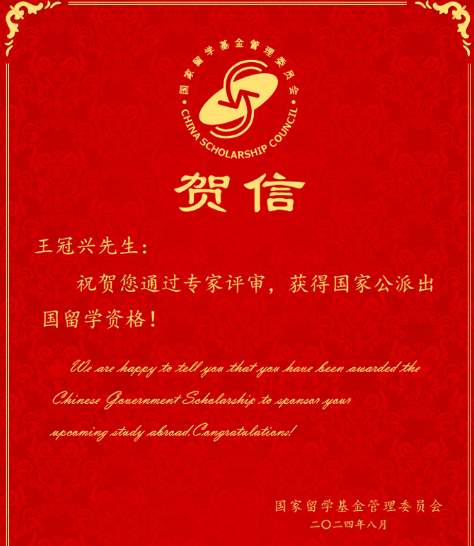
China Scholarship Council Scholarship
Funded visiting PhD research at the University of Auckland.

Beijing Outstanding Graduate
Recognized for outstanding academic achievement and comprehensive performance.

First-Class Scholarships
Received multiple municipal- and university-level scholarships for academic excellence.

National Level-II Athlete Standard in Marathon Running
Long-term endurance athlete with 20+ races completed.

AHA / Red Cross First Aid Instructor
Certified first aid instructor with experience supporting large-scale events.

Outstanding Student Leader (3 Awards)
Recognized three times for leadership, teamwork, and contributions to student activities.
Leadership & Activities
Summer Teaching Volunteer Program, China
- Initiated and organized educational outreach programs in rural areas, coordinating volunteer recruitment, curriculum design, school engagement, and team management.

American Heart Association & Beijing Red Cross
- Delivered CPR and first-aid training to more than 1,000 participants across universities, companies, and public events.
